
Royal Highland land-use change for 7.53 acres west of US 27
This item did not move forward: denied.
A small-scale comprehensive plan amendment changing about 7.53 acres west of U.S. Highway 27 and south of the Florida Turnpike from Lake County Urban Low Density to City of Leesburg Low Density Residential, for the Royal Highland project (owner: AM4530, LLC). Planning and zoning staff recommended approval. It was on the City Commission agenda on Sep 8 and Oct 13, 2025.
More in YalahaGet monthly updates
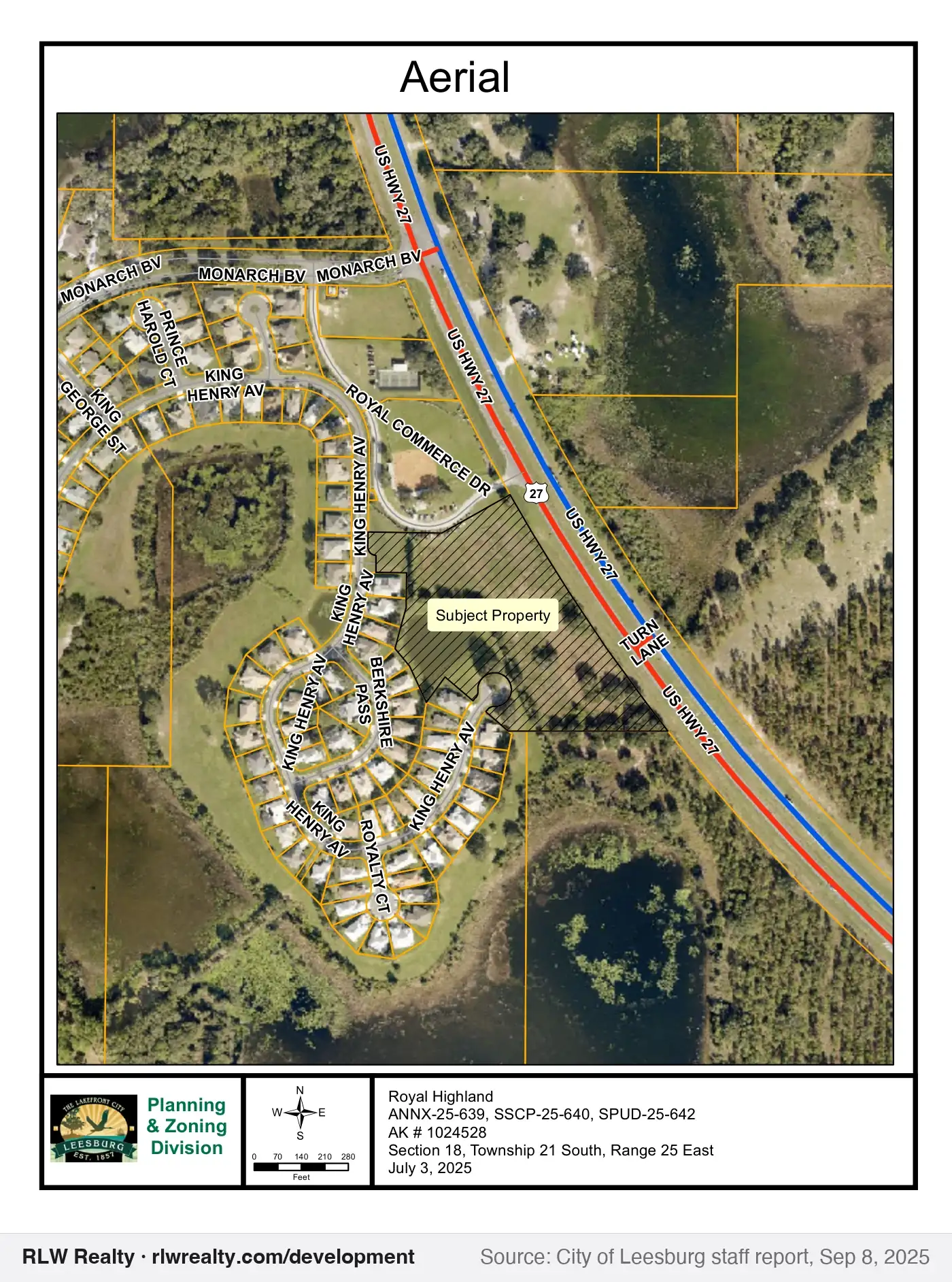
Outline shows the parcel(s) named in the record. Zoom in for 2025 county aerials.
Key facts
- Type
- land use change
- Status
- denied (October 13, 2025)
- Government
- Leesburg
- Near
- Yalaha
- Location
- West of U.S. Highway 27 and south of the Florida Turnpike, Leesburg
- Size
- 7.53 acres
- Applicant
- AM4530, LLC
- Case / record
- SSCP-25-640
What this means
A comprehensive plan or future land use map amendment changes the long-range land-use category for land. It sets the range of zoning that can later be allowed. How this process works →
Timeline & official records
- September 8, 2025Leesburg City Commission Agenda, Sep 8, 2025
- October 13, 2025Leesburg City Commission Agenda, Oct 13, 2025
How we placed this on the map
- Alternate key(s) 1024528 named in the record
Property appraiser: Alt Key 1024528
Compiled by RLW Realty from public records; summary written from the staff report. Status can change between our weekly updates; confirm with the agency before relying on it.
Also nearby
Own property near here?
New projects change what nearby homes and land are worth. We'll tell you what this one could mean for yours.