
County road project: CR 561 - SR 19 to south of CR 448
- Proposed
- Approved
- Building
- Done
Lake County Public Works project: CR 561 - SR 19 to south of CR 448 (improvement study). County status: planned. Funding source listed by the county: road impact fees north central Lake County.
The road work
Study (PD&E)A Project Development & Environment study: engineers compare route and design options, look at environmental effects and hold public meetings. No design or construction is funded yet.
1.7 miles
County schedule
- Start · 2028
- Funding · Road Impact Fees North Central Lake County
See it on Street ViewOpen in Google Maps
Street View shows the road as it looks today, at the middle of the work zone. Schedules can change.
More in TavaresGet monthly updates
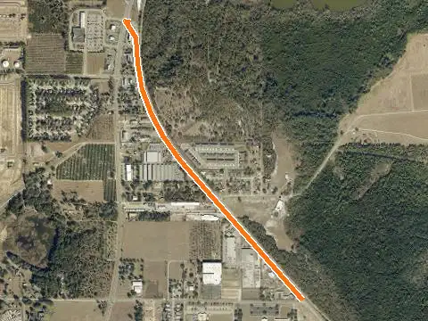
Orange line: where the work is planned (S = start, E = end). Zoom in for 2025 county aerials.
Key facts
- Type
- roads & public works
- Status
- planned
- Government
- Tavares
- Near
- Tavares
- Location
- Near Tavares
What this means
Road, drainage and utility projects funded by the state, county or a city. Dates and status come from the agency’s own project records.
Timeline & official records
How we placed this on the map
- Road segment mapped from the Lake County Public Works GIS (1.7 miles)
Compiled by RLW Realty from public records; summary written from the record fields. Status can change between our weekly updates; confirm with the agency before relying on it.
Also nearby
Own property near here?
New projects change what nearby homes and land are worth. We'll tell you what this one could mean for yours.